热门产品
Remote Sensing
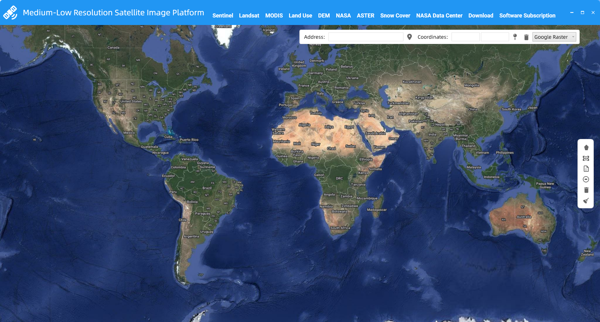
Medium-Low Resolution Satellite Image Platform
The Next-Generation Remote Sensing Data Download Platform – Say Goodbye to Tedious Work, Hello to One-Click Access
核心特性
- One single platform integrating mainstream remote sensing data such as the Sentinel series, MODIS series, Land Use, DEM, Snow Cover, and more.
- No more one-by-one downloads. Simply define your area with a rectangle, polygon, or by uploading your SHP file to initiate a batch download task with a single click.
- Our built-in download manager automatically detects and re-downloads failed files, ensuring you get a complete dataset without manual intervention.
- Meet your diverse project needs with more precise and efficient data retrieval.
选择授权类型
原价
月度授权
$10.00
每月
- ✓ 完整功能访问
- ✓ 技术支持
- ✓ 软件更新
- ✓ 1台设备授权
节省10%
季度授权
$27.00
3个月
- ✓ 完整功能访问
- ✓ 优先技术支持
- ✓ 软件更新
- ✓ 1台设备授权
推荐
节省25%
年度授权
$100.00
12个月
- ✓ 完整功能访问
- ✓ VIP技术支持
- ✓ 软件更新
- ✓ 1台设备授权
一次购买
永久授权
$150.00
终身使用
- ✓ 完整功能访问
- ✓ 1年技术支持
- ✓ 1年免费更新
- ✓ 1台设备授权
机器码用于生成专属的授权文件,确保软件只能在您的设备上使用
总价: $100.00
年度授权 • 支持PayPal转账 • 24小时内处理